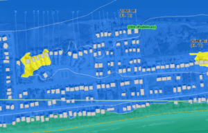
 In August 2014 new preliminary flood maps were released for our area. They showed 92% of property owners would benefit from the maps. The new flood zone designations would result in savings of thousands of dollars annually for many property owners. Building Inspector Tim Evans did a presentation on the new maps at the October 2014 Commissioners’ Meeting and we posted about it here. (Note: The Town walked back the idea that the maps were effective immediately.)
To date, the maps have been delayed and there has been no clear expectation of when they will be effective. At the February 2017 Commissioners’ Meeting, HBPOA Board Member Mike Sullivan spoke about the importance of getting the maps in place and urged the Commissioners to act. The Commissioners passed Resolution 17-01. The Resolution has been distributed to all of our representatives.
In addition, several HBPOA Board Members attended Representative Rouzers’ Town Hall meeting at BCCC to communicate the importance and urgency of the issue.
We have heard back from Congressman Rouzer’s staff:
At long last, I have some information for you about the flood maps for Holden Beach. It looks like they pushed the date back by one year due to ongoing appeals to the proposed maps. I’m sorry I don’t have better news, but the complicated nature of the flood map drafting and implementation process leaves lots of opportunity for delays. You can find the email I received from our contact at FEMA about it below.
The good news is, just yesterday Congressman Rouzer signed on as a cosponsor for a bill that would require the Government Accountability Office to review flood insurance rates and flood insurance rate maps under the national flood insurance program within the year of the bill’s enactment and every subsequent four years thereafter. This would help ensure maps stay up to date and prevent people from paying more than necessary for their insurance premiums. The bill is HR 879, the Flood Insurance Integrity Act.
FEMA’s Region 4 staff have provided the following information. They are the subject matter experts on specific maps.
- Brunswick County is part of the Lumber Basin, and it has a projected Letter of Final Determination Date of 7/19/17, which makes the Effective Date: 1/19/18.
- It is also part of REG-NC Cape Fear (C) & Lumber (W) Basins Missing Panels: PMR8 which dealt with missing panels from Brunswick and a few other counties.
- The Village of Bald Head was left off the original Flood Hazard Determination Notice (FHD) Notice, so it ran through an Appeal Period by itself.
- NC’s Floodplain Management Program was waiting for the missing panels to go through the Appeal Period and then have them go Effective with the Brunswick county panels in the Lumber basin.
- Supply, NC is an unincorporated community in Brunswick County.
HBPOA encourages everyone to contact their Federal, State and County elected officials. We have drafted sample letters which you can use, but individual calls and letters are sometimes more effective than form letters. The letters are for the Congressmen representing Holden Beach. If you are not a full-time resident you can find your elected representatives here.
Click below for the letters:
Check Your Property’s Flood Map Changes
You can check to see what the new flood maps for your property will be by clicking here. Zoom in to your property and you can determine what your current designation is. Click on your home and get all the details on the right side of your screen. Use the drop-down menu in the top right corner to change from Effective to Preliminary. This is what your new flood rating will be. Again, click your home to see the changes. Many properties go from a VE designation to AE – which will significantly lower insurance premiums. Most properties also have a lower Base Flood Elevation (BFE) which will also lower premiums.
